
The Chester Integrated Trails Plan was made possible by the financial support of the Association of New Jersey Environmental Commissions (ANJEC), the Chester Historical Society, the Chester Borough Open Space Trust Fund, the Chester Township Open Space Trust Fund, and the Raritan Highlands Commission/North Jersey RC&D.
The Project Team would also like to acknowledge the following individuals and organizations for their assistance:
Morris County GIS: Stuart Walter, Janice Peal, and Steve Rice;
Chester Township: Mayor William Cogger, Councilman Matt Kass, and Sarah Jane Noll;
Chester Borough: Mayor Robert Davis;
Morris County Parks: Tom Edmunds, Russell Nee, and David Helmer;
Ben Spinelli, Tony Flamino, Dr. John Puffer, Gracie Harrigan Consulting Foresters, Marty Epstein & Jesse Epstein of Marty’s Reliable Cycle, and Tuen Ott; The comments and feedback from the Chester Township Environmental Commission and the Chester Borough Environmental & Open Space Committee.

Click here for the Final Integrated Trails Ecosystem Plan for Chester.
Click here for a set of high resolution maps included in the report.
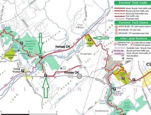
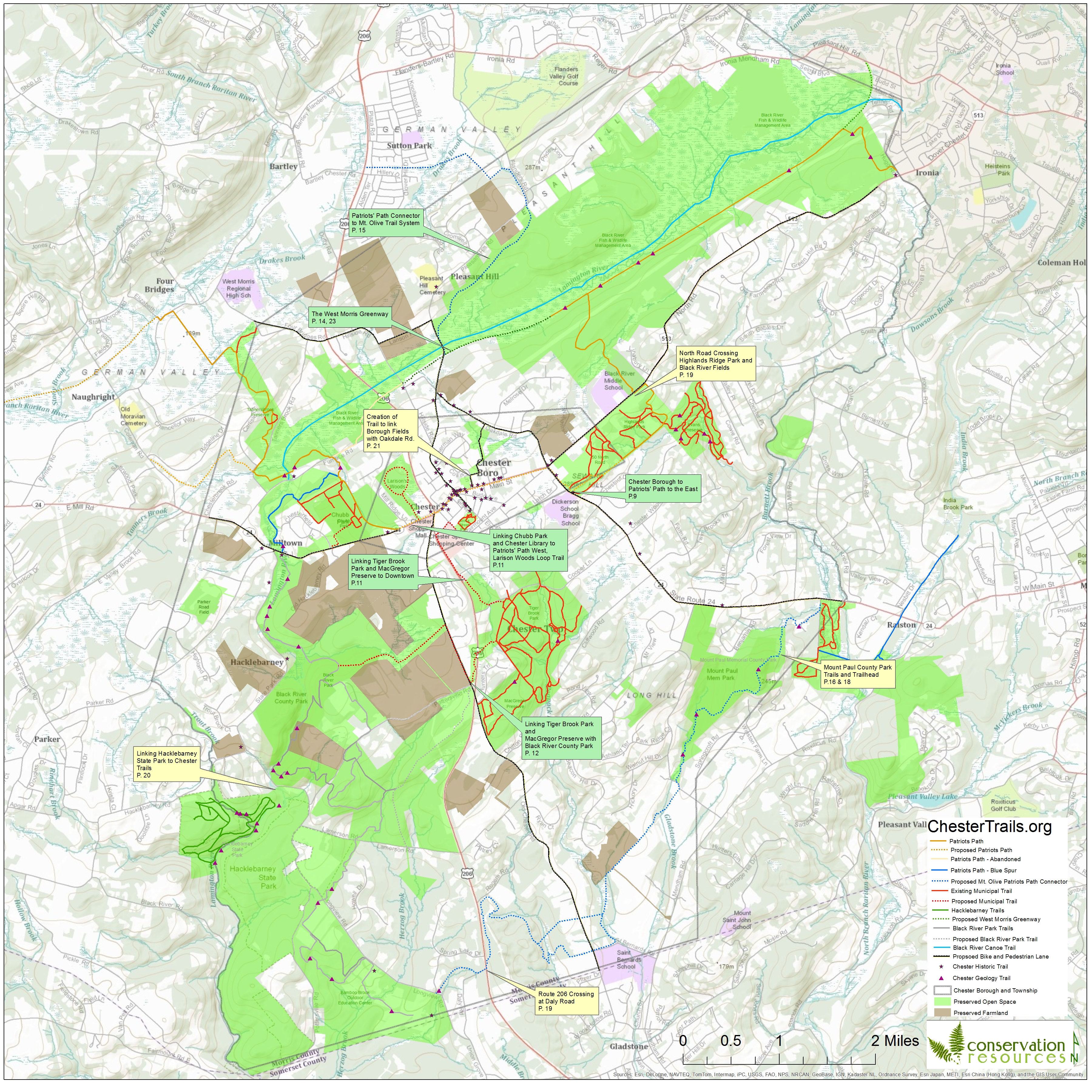
Click here for a high resolution (jpeg) map showing all existing and potential trails in Chester.
Click here for an interactive map showing all existing and potential trails in Chester.
Click here for the KMZ (Google Earth) file of existing and potential trails in Chester.
Click here for the KMZ (Google Earth) file of preserved Open Space and Farmland in Chester.